Zavala County Leadership
Connecting rural upstream watersheds to downstream communities through Corvalent's CorGrid platform — under Texas DIR Contract DIR-CPO-6230 — for earlier awareness and coordinated response.
Flood risk is regional: rainfall and water levels often change first in rural upstream areas before reaching downstream roads, crossings, and critical facilities. When monitoring systems operate in isolation, agencies lose time. FEWS connects upstream rainfall, creek, river, and reservoir data with downstream urban monitoring into one common operational picture.
The D.H. Collective LLC is the prime holder of Texas DIR Contract DIR-CPO-6230 (Flood Early Warning Systems Technology Solution Products and Related Services), active June 4, 2026 – June 4, 2031 — a cooperative procurement path open to eligible public entities, covering implementation, SaaS, monitoring, and support. Official page: dir.texas.gov/contracts/dir-cpo-6230.
The FEWS ecosystem brings together The D.H. Collective (prime), Projexel (systems integration), Corvalent CorGrid (sensing & analytics), TALON (sensors), and BLCCS (software & dashboards).
SOURCES: Texas DIR Contract DIR-CPO-6230 / RFO DIR-CPO-TMP-608; Deloitte — Smart Cities & Urban Transformation; McKinsey — Smarter Cities Are Resilient Cities.
Corvalent is a 32-year-old American IoT/AIoT technology company. CorGrid is its modular, scalable platform connecting sensors, gateways, and operational workflows into one unified environment — giving a real-time view of rainfall, water levels, reservoirs, low-water crossings, and device health.
Rain gauges, creek sensors, and reservoir instruments are correlated with downstream roads, bridges, and crossings for one connected watershed view.
CorGrid consolidates every sensor, jurisdiction, and alert into one dashboard — accessible from any browser, PC, tablet, or phone.
Configurable thresholds trigger advisory, watch, warning, and critical alerts to the right personnel by location and severity.
Sensors, cameras, and beacons trigger alerts and activate warning equipment at roads, bridges, and pump stations.
Continuous device-health monitoring flags weak batteries and failing sensors before they go offline.
Historical data supports after-action reviews, grant applications, and future system expansion.
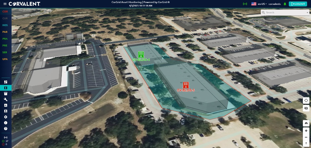
Sample screens from Corvalent's CorGrid platform, illustrating the kind of real-time monitoring, asset visualization, and geospatial views that can be configured for Zavala County's flood-warning assets.
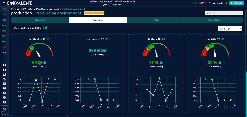
Air quality, barometric pressure, battery, and humidity gauges with historical trend charts.
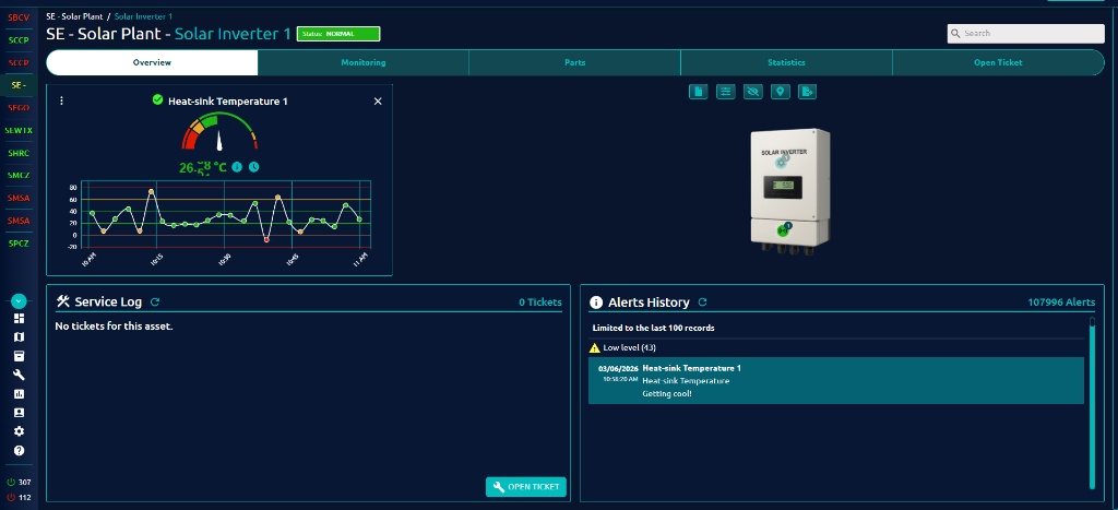
Per-asset overview with live readings, service log, and full alerts history.
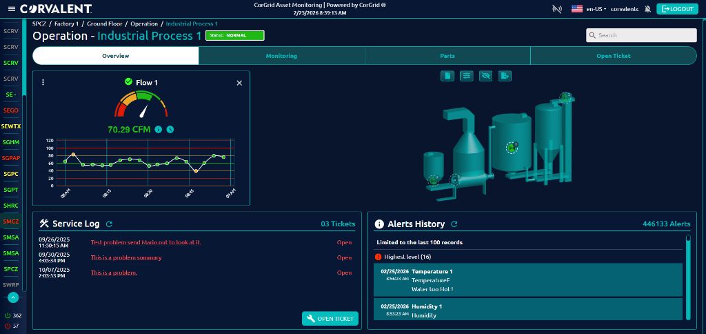
Flow monitoring paired with 3D asset visualization, tickets, and alert history.
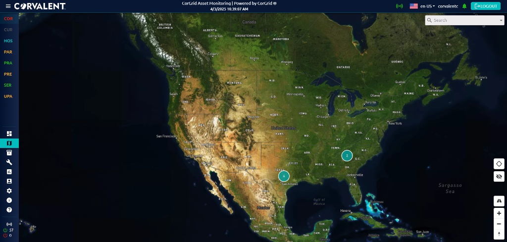
Portfolio-wide map view locating every monitored site and facility.
Aerial 3D visualization of monitored buildings, boundaries, and asset status.
These views illustrate CorGrid's flexibility — the same platform can be configured for Zavala County's watersheds, crossings, and critical facilities.
Hydrological sensing, multi-network telemetry, GIS, and AI/ML analytics — combined with cybersecurity and governance.
An audio companion discussing the FEWS program, CorGrid platform, and how connected upstream/downstream monitoring supports communities like Zavala County.
Reference documents and links supporting this proposal.
Flood Emergency Warning System (FEWS) for Zavala County — the complete written proposal, prepared by Joe Trujillo, CEO, Projexel LLC.
One consistent view for emergency management, public works, and public safety teams.
Upstream monitoring adds lead time before downstream roads and homes are affected.
Connects flood data to roads, bridges, utilities, schools, and emergency facilities.
Geographic risk data helps prioritize inspections, closures, and personnel deployment.
Automated alerts and auditable histories support accountable decision-making.
The same environment can later add public safety, mobility, and environmental monitoring.
Zavala County is our active first prospect for the FEWS program. Discussions are focused on flood-warning needs, priority locations, funding, and long-term maintenance — coordinated directly with County leadership and emergency management staff. County website: co.zavala.tx.us.
Basin Sense IQ is a demonstration dashboard used to guide discussion with County staff — not an operational Zavala County system of record.
A phased approach that validates results before scaling across the full jurisdiction.
Identify priority watersheds, crossings, and critical facilities; review existing infrastructure.
Define thresholds, escalation paths, and measurable KPIs such as warning lead time.
Deploy and validate CorGrid on selected upstream/downstream locations under real conditions.
Expand the validated model across additional watersheds and jurisdictions.
Zavala County can establish a scalable flood-intelligence foundation connecting rural upstream conditions with downstream roads, crossings, and communities — the foundation for earlier awareness and future Smart County capabilities.
What would be the best date and time to meet with the Zavala County team to begin the Discovery Workshop?
Schedule the Workshop
Joe Trujillo — CEO, Projexel LLC — Enterprise IT Strategy & Lifecycle Governance